Currently browsing category

Day Meets

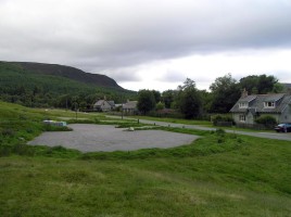
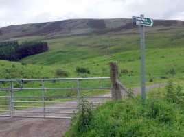
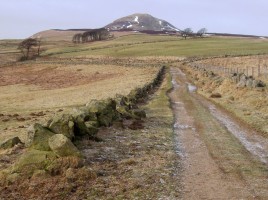
19th August 2018 – The Lomond Hills

Map xx, Grid Ref 704740 ?? The Lomond Hills have a rich and varied history. From the Iron Age are the remains of several hill forts, which can be found around the summits of both East and West Lomond as well as at Maiden Castle, a grassy knoll that lies …

21st October 2018 – Linn O’ Dee

Linn o Dee (Map 43, Grid Ref 063897) This is the gateway to the high mountains of the southern Cairngorms and a great access point into Glen Derry and Luibeg via Derry Lodge, and through the superb expanding Caledonian pinewoods in these two scenic mountain passes, or via the Chest …

16th September 2018 – Invercauld

Distance: 16 miles/26km Ascent: 3215ft/980m Time: 6-7 hours Start/finish: Large layby on A93 at Inver, opposite red telephone box (GR: NO 234938) Maps: Ordnance Survey 1:50,000 Landranger sheets 43 (Braemar & Blair Atholl) and 44 (Ballater)Route: Follow minor road, then track to Ballachlaggan. Turn R on grassy path, climb past …

16th December 2018 – Glen Tanar

Map 44, Grid Ref 480965 Pay for car parking so remember some change. There is a visitor centre & toilets near the car park. Many route options for the shorter winter days. There are plenty of well marked paths in Glen Tanar, on either side of the Water of Tanar. …

19th February 2017 – Lochnagar

Map 44, Grid Ref 310851 “England! thy beauties are tame and domestic, to one who has roved o’er the mountains afar. Oh, for the crags that is wild and majestic! The steep frowning glories of dark Lochnagar!” So wrote Lord Byron who climbed Lochnagar from Invercauld by the Garbh Allt, …

16th April 2017 – Glen Glova

Map 44, Grid Ref 283761 Glen Doll lies within the Cairngorm National Park at the top of Glen Clova, in an area of steep hills, Corries and Munros. It includes Corrie Fee Nature Reserve which has many endangered plants. The ancient track Jocks Road starts in the glen and ending …

16th July 2017 – Invercauld – Culardoch & Carn Liath

Map 43/36??, Grid Ref 187914 Vast kilometres of tracks for cycling and walking some of the higher tops, travelling via old rights of way, passing several crofts, the area has a rich history. With good access to Ben Avon, Ben a Bhuird, Cullardoch, Carn Liath and Loch Builg. Great views …

20th August 2017 – Glen Muick

Map 44, Grid Ref 274818 Corrie Chash and Broad Cairn (6180m) – Cairn Bannoch (1012m) Loch Muick occupies a dark, steep sided glen on the Royal family’s Balmoral Estate. It offers numerous levels of walking for all, including families. The Glas- Alt- Shiel Queen Victoria’s holiday home she built for …

15th October 2017 – Hills of Cromdale

Map xx, Grid Ref 075286 Often known as the Haughs o Cromdale, a long arc above the old settlement of Cromdale. These hills held many illicit stills for whisky and is home to one of the oldest distilleries left. The summit to Clash nam Piobair or best known as the …

10th December 2017 – Glen Esk

Map 44, Grid Ref 447804 From the car park at the head of Glen Esk, a relatively easy ascent of the most easterly Munro, Mount Keen, can be made. The route goes via Glen Mark to join the track on the west side of the Ladder Burn, then north to …

20160417 17th April 2016 – Glenshee

(Map 43, Grid Ref 139 782) The opportunities are numerous, especially using the elevation of the Ski Centre (650m). Numerous hills West and East side of the A93 can be climbed. Glas Maol, Creag Leacach, Carn an Tuirc, Carn Aosda, Cairnwell, Carn na Sac, Carn a’Gheoidh. A few good rounds …

20160717 17th July 2016 – Ben Rinnes

Ben Rinnes is a fine isolated hill situated to the south west of Dufftown. Its distinctive conical shape can be seen from many parts of the Grampians and it most easily climbed from the car park on the road to Edinville. A visit to the tors on the north west …

20160821 21st August 2016 – Tomintoul

(Map 36/37, Grid ref 170186) As the highest village in Scotland, its a great starting point for many hills, Munros or Grahams. North along the Strath Avon lie the hills of Cromdale, where reindeer can often be seen on the high tops. A bike is most useful to follow the …

20160522 22nd May 2016 – Glen Moy

(Map 44/45, Grid Ref 391 627) This glen is next to glen Clova and you can start walking from there at (373653), a car parking area on the B955, the right hand Clova Road. Quite a few tops to cover Manywee (685m), Firmbacks (756m), Craigthran (550m), total ascent over (914m) …