20th July 2024 : Day Meet – Achallater to Glen Doll via Jock’s Road
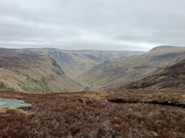
Bus transport for walkthrough from Achallater to Glen Doll via Jock’s Road. Walk through from Auchallatar to Glen Doll Ranger’s car park. OS Maps 43 (Braemar & Blair Atholl), and 44 (Ballater & Glen Clova)Start point: Auchallatar Farm Grid Ref: NO 155883.Walk distance: 19.5 kmsEstimated Time: 6 Hours 30 minsAscent: …