18th April 2026 : Day Meet – Bridge of Dye to Cairn o’ Mount Viewpoint
Bridge of Dye to Cairn o’ Mount Viewpoint walkthrough via Clachnaben and the Corbett, Mount Battock.
OS Landranger: Map Sheet 44 Ballater & Glen Clova
Sheet: 45 Stonehaven & Banchory
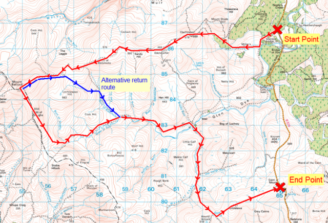
Start Point: Glen Dye car park NO648867
End Point: Cairn o’ Mount viewpoint NO650805
Distance from Stonehaven to Start Point: 21 miles via Slug Road
Drive time from Stonehaven to Start Point: 40 minutes
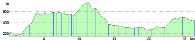
Walk Distance: 27km
Estimated Duration: 9hrs
Approximately Ascent: 1220m
From the car park head west to the summit of Clachnaben and on westwards via Hill of Edendocher and Hill of Badymicks to the summit of the Corbett, Mount Battock. From there head roughly south east to the Hill of Saughs and down the shoulder until we meet the path down Glen Dye, take the path for approximately 6km to Charr. Cross the Water of Dye by the bridge, head south on the track for 2½km to Old Hangy Burn. From there we head cross-country east to the summit of Cairn o’ Mount and the nearby Viewpoint where the pre-positioned vehicles will return walkers to the Start Point.
Route Profile:
For more information please contact Willie Morris.