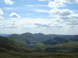
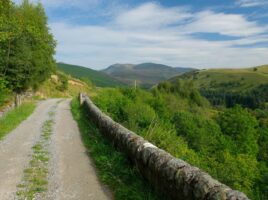
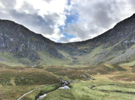
Currently browsing category

Day Meets

15th August 2021 : Day Meet – Pentland Hills

To be confirmed. OS Maps 65(Falkirk and Linlithgow) & 66(Edinburgh) The hills can be accessed from Flotterstone Ranger Centre (NT232630) on the A702 from where a variety of rounds of varying length can be made, the longest, (24 km, 1470m), taking upwards of 8 hours. The area is steeped in …

17th October 2021 : Day Meet – Glen Cairn

To be confirmed. OS Maps 36(Grantown & Aviemore) & 37(Strathdon & Alford) (This walk assumes that car sharing is once again allowed) Not so much a through walk as a circuit with a bit of a car shuttle at the start and finish. Cars should be left at NO256966, the …

19th December 2021 : Glen Prosen

To be confirmed. OS Map 44 (Ballater & Glen Clova) Glenprosen, a glen and a quoad sacra parish in Kirriemuir parish, NW Forfarshire. The glen is that of Prosen Water, rising at an altitude of 2750 feet on the western slope of Mayar, and running 18 miles south-eastward through the …

18th October 2020 : Glen Cairn

Maps 37 & 36 Not so much a through walk as a circuit with a bit of a car shuttle at the start and finish. Cars to be left at NO256966, the start of the walk and NO235939 where the walk will end. 24 km, 810 m. The walk starts …

13th December 2020 : Glen Prosen

Map no.44 Glenprosen, a glen and a quoad sacra parish in Kirriemuir parish, NW Forfarshire. The glen is that of Prosen Water, rising at an altitude of 2750 feet on the western slope of Mayar, and running 18 miles south-eastward through the northern division of Kirriemuir and along the borders …

16th February 2020 : Lochnagar & High Tea at Station

If weather permits the walk will be to Lochnagar Meet 7:00am in the Square . Contact John McPherson on 07772981042 Map 44, Grid Ref 244861 Stonehaven Square 7am Please inform John McPherson if attending 07772981042 Station Hotel High Tea 7:30 Please inform Anne Sinclair of choice of food if attending …

Beinn Bhrotain

20th October 2019 : Beinn Bhrotain

Map 43, Grid Ref 954923 In order to fulfil the Club’s commitment to ‘The Munro Table’, an environmental community project celebrating the death of Sir Hugh Munro, October’s meet shall aim to summit the Club’s chosen Munro, Beinn Bhrotain. Bicycles may prove advantageous on the long approach from the Linn …

16th August 2020 : The Pentland Hills

Maps 65 & 66, Grid Ref tbc These fine grassy hills just to the south of Edinburgh are well seen whilst driving south through Fife. The highest point is Scald Law (579m) but there are numerous other tops and several reservoirs and an artificial ski slope. The hills can be …

24th March 2019 – Carn Cloich Mhuilinn

No other Munro is better known for its subsidiary top. Carn Cloich-mhuilinn is the one that got away, for Hugh Munro had been keeping this for the last one, but he died without completing the Munros and tops. It is 942m, but the rise from Beinn Bhrotain, to the NW, …

15th December 2019 – The Cabrach

Map No 37 If going please contact John McPherson on 07772981042 Meet in the square at 7:00am The Cabrach is a unique and beautiful location rich in cultural heritage, typified by its haunting landscape and the great numbers of tumble down crofts and steadings, which today litter this upland plateau. …